Overhead Range Map
Open Full Size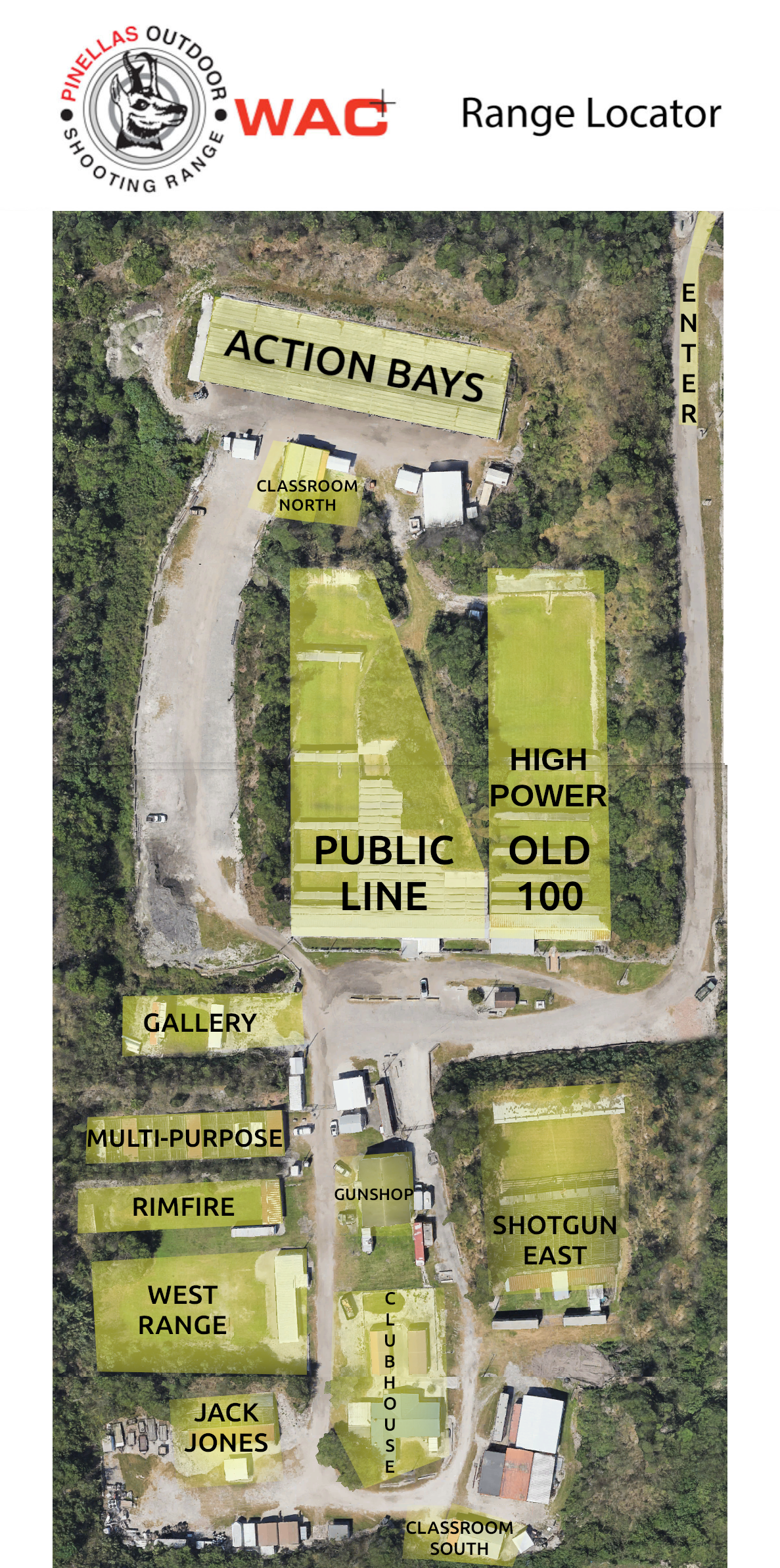

Use the overhead range map below to identify range areas, access points, and the general facility layout before your visit.
On mobile devices, scroll horizontally inside the map area or use “Open Full Size” for easier viewing.